The name of the island Ambon is
believed to come from the word apon, meaning "plantation'. Indeed, Ambon
was one of the firsts Moluccan islands to be occupied by the Portuguese and
used as a plantation. Ambon City is the Main City and seaport of Ambon Island,
and is the capital of Maluku Province. It is one of the largest cities in
eastern Indonesia. Ambon, the provincial capital of Maluku, which is built on a
hillside overlooking the bay, has a number of interesting sites of historical
and cultural interests. Among them are the remnants of some old forts built by
the Dutch East Indies Company during the heydays of the spice trade and the
Siwa Lima Museum with its local arts and crafts collection. More ruins of forts
are found such as the Dutch one at Lima and those of the Portuguese at Hila,
which are almost entirely hidden underneath the contorted roots of a giant
Banyan tree.
The ANZAC War Cemetery near Ambon town
is the site of services held every year to commemorate the Allied soldiers who
died in the region during world War 11. Ambon is at Maluku end of the annual
yacht race between Darwin, Australia and Ambon. The race usually takes place in
August. Ambon, as a beautiful city, has a lot of tourism objects that offer the
tourist much beautiful scenery. On arrival in AMBON, you will be met at
Pattimura airport, transfer to your hotel. After lunch, visit WAISELAKA POND in
WAAI, its clear crystal water inhabited by holy eel, The Crazy Bamboo
Performance. You can have dinner and overnight at your hotel.
Ambon,
the provincial capital of Maluku which is built on a hillside overlooking the
bay, a number of interesting sites of historical and cultural interest. Among
them are the remnants of some old forts bulit by the Dutch East India company
during they heyday of the spice trade and the Museum Siswa Lima with it’s
collection of local arts and crafts.More ruins of forts are found elsewhere on
Ambon Island, such as those of a Dutch one at Lima and those of the old
Portuguese fortress at hill, on the other side, which is almost entirely hidden
underneath the cntorted roots of a giant bayan tree.
The ANZAC War
Cemetery near Ambon town is the site of services held every year to commemorate
the Allied soldiers who died in the region during World War II. Ambon is at the
Maluku end of the annual yacht race between Darwin, Australian, and Ambon
usually takes place in August.
Maluku tourism profile that contains
the object and appeal as well as visiting the Moluccas, are realities that are
so promising potential for tourism, especially for tourists to come visit it's
time to see the natural beauty include: Availability of appeal in accordance
with the characteristics of the underwater area as the Maluku islands, volcano
Area hills' natural scenery, Gulf, Lakes and Hospitality Molucan community that
has been known since long ago with the tradition of community that considers
"Tourists As the King".
Maluku its approximately 1000 islands
support a population of less than 1.7 million people. The average population
density figure is 19 people per-square kilometer, but the distribution is
uneven. Air and sea transportation is the main means, which link the islands
together. The province has 32 seaports and 20 airports, and only about 160 km
of roads. However, good roads on many of the islands provide easy access to the
often-remote places of tourists' interest.
Maluku lies in the transition zone
between Asiatic and Australian flora and fauna and has a tropical climate.
Maluku's flora includes meranti trees and many kinds of orchids; distinctive
fauna includes cuscuses, birds of paradise, wild goats, and parrots. The
economy is based on subsistence agriculture, especially sago (the sago palm,
producing a starch used in food), and on the export of such products as spices,
cacao, coffee, coconuts, fish, and minerals. Important indigenous groups
include the Ambonese.
A great variety of endemic plant and
animal species are found in the rugged forest-covered and mountainous
hinterlands of most of the islands. A few of the best known are the
Rucker-tailed kingfisher, the red-crested Moluccan cockatoo, and various
brilliantly colored lorikeets and parrots. Most of Maluku sits astride one of
the world's most volatile volcanic belts.
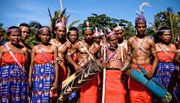
The unique dress
worn by Maluku women is Manampal coat which is a unique Ambon coat.For formal
ceremonies, Maluku men usually wear red or black color coat with laced under
wear and belts.The women wear Cele dress, a kind of coat, adorned with
earrings, necklace, and rings.The women usually bring Lenso Pinggang in certain
ceremonies, that is a white handkerchief which is how rarely laid at hip.
Ternate, a little
island off the west coast of Halmahera in notrhern Maluku, was once the seat of
an important kingdon which prospered from the spice trade. The Portguese, the
Spanish and the Dutch vied with each other for influence on this island. The
old sultan’s palace in Ternate town is now a museum. In the vicinity are the ruins of old Portuguese. Spanish
and Dutch forts. The remnants of the Dutch fort Orange are right inside the
town.
About five
kilometers west of the town, on the slope of the 1.715 meters tall volcano in
the middle of the island, is Afo, with it’s giant clove tree, said to be more
than 350 years old. Morotai Island, just off Halmahera’s northern
arm, was an important airbase during World War II. First for the Allies, and
later for the Japanese until it’s recapture near the end of the war. The ghosts
of war still linger in this area, where many wrecks of aircraft and rusting
guns lie abandoned in the bushes.
The group about 160
kilometers southeast of Ambon consist of three larger islands and 7 smaller
ones, perched on the rim of Indonesia’s deepest sea, the Banda sea. Near the
island Manuk, the water reaches a depth of more than 6.500 meters.Of the three
biggest island, Banda, Banda Neira and Mount Api. The first to are covered with
nutmeg trees and oother vegetation. The third, is entirely bare and highly
volcanic. The last eruption of Mount Api occurred only a few years ago.The seas
around Banda are the site of the famous Maluku sea gardens with their bright
corals and colorful fish darting through the crystal clear waters. Facilities
for sightseeing, snorkeling and skin diving are available, as well as clean,
comfortable cottages, banda saw some of the bloodiest episodes of Maluku’s
history pass during the 17th century.
In 1609, the Dutch
East India Company (VOC) dispatched Verhoeff to the islands to obtain the
contested spice trade monopoly at any cost. Confronted by a superior power, the
people of Banda were forced to allow the company the establishment of a fort,
but in that same year Verhoeff was killed together with 45 to his men. The
company retaliated, but peace was not restored.In 1619, VOC Governor, General
Jan Pieterszoon Coen arrived at the head of a penal expedition and exterminated
the entire population of Banda. The land
was divided into lots, called perken, and given to former company employees, the
perkiniers, who were obliged to grow nutmeg and sell them at predetermined
prices to the company. Slaves did the actual work on the fields.
The old perkeniers
houses, or what is left of them, and old churches still lend a peculiar
colonial character to the port town of bandaneire today. Two old forts, Belgica
and Nassau, are inside the town limits. Others are found elsewhere on the
islands. Available also the former Dutch Governor’s Mansion, the Museum of
History in Neira, and the huge nutmeg plantation nearby.
The objects interesting are:
Marine Park, Pasir Panjang, Liang Beach, Coral Sea Gardens, Seram Island, Natsepa
Beach
Victoria
Fortress, Pattimura Monument, Mount
Api, Tual, Lelisa
Beach, Siwalima Museum, Tanjung, Santai
Beach, Felawatu Beach, Pintu
Kota
For complete information you
could have on the “Text Book Guiding To Indonesia” By F. I. Fatrick.
The
capital of Maluku, Ambon could be reached from Jakarta and other major cities
and ports by sea and air. Air and sea transpot are also the links that connect
Ambon with some of the major towns elsewhere in Maluku, such as Ternate and
Tual in the Kai Islands. Land transportation is available only in the city.